I've got to share share this with you. This is how my invitation to Transformers premiere looks like:
It contains several more or less usable goodies some of which do a good job of transforming (play the video):
I have no idea how expensive this is and how many of them they made but I;ve got a feeling that if they could have money to put one extra Transformer in the movie (small one)...
P.S: There were some rather nice hi-res renders on the CD.
Tuesday, July 31, 2007
Wednesday, July 25, 2007
Panoramio
I first heard about Panoramio.com when their photos began appearing as layer in Google Earth, to my neverending annoyment - because large percentage of famous Prague sights in Panoramio has completely wrong location. People probably just take a picture of Charles' Bridge and then randomly slap it somewhere in the general location of Prague.
Recently, Panoramio also appeared as layer in Google Maps (click on "My Maps" to toggle it on/off). By the way, I think Google does terrible job of explaining how useful and powerful tool these new Google Maps layers are.
I started correcting some Panoramio placements, I created an account there and tried uploading some of my photos there. I was rather pleasantly surprised that their www upload interface is much better than Flickr's or PicasaWeb's. Of course, Panoramio is now owned by Google and I hope PicasaWeb integration will be much tighter in the future (PicasaWeb already allows geotagging your photos). I'd consider switching from Flickr to PicasaWeb right now if it wasn't for their weird payment policy. You see, at Flickr, I pay yearly amount that allows me to upload 2 Gigabytes of photos every month. For approximately same amount of money (each year), PicasaWeb allows me to upload 7 Gigabytes of photographs in total!!! If you want to use the online storage to keep the highest-quality originals of your photos (easily 5 Megabytes per single photo), PicasaWeb's business model is absolutely unacceptable.
But back to Panoramio: I discovered that neither GoogleEarth nor Google Maps display all Panoramio photos. If you go directly to Panoramio, you can see much, much more photographs and I find it extremely informative for example to be able to see how specific parts of Mallorca island look before deciding which part you'll grace with your presence.
You can also embed "Mini-Panoramio" right inside your web page, as seen above.
P.S: As pointed out by my esteemed readers, Flickr no longer has any limits on uploaded photos. That makes the difference between Flickr and PicasaWeb even more glaring. Unfortunately, the "mapping" portion of Flickr is far behind Panoramio or PicasaWeb, the Yahoo Maps being inferior to Google Maps both in functionality and available map data.
Sunday, July 22, 2007
The Truth About Catholic Church
I never really knew very much about religion. That's why I'm glad somebody made this video.
And I guess this one is somehow related:
Labels:
adult,
pornography,
religion,
video
Friday, July 20, 2007
Thursday, July 19, 2007
Friday, July 13, 2007
Sweet Lo-Fi Music From YUO
Download some free (legal) minimalistic electronica. There's also a music video.
The band is called "Fuck Yuo I Am A Robot".
Monday, July 09, 2007
Sunday, July 08, 2007
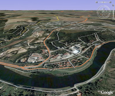
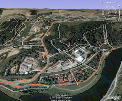
Get To Know Your Terrain Elevation
You can find the following trick useful if you are using Google Earth to plan your bicycle trips and you want to have a good idea how steep your journey will be.
Using standard Google Earth projection, this is not very clear (click for large version):
However, you can go to "Tools / Options / 3D View", find a box called "Elevation Exaggeration" and enter maximum possible value here (currently 3.0), instead of default 1.0. The effect is that elevation is now exaggerated to 300% of the original and you can rather clearly see how difficult the journey will be (again, click for large version of the same part of the globe):
P.S: If you have really good brakes, your bicycle can stop on the spot while your body continues moving forward. Hilarity ensues!
Friday, July 06, 2007
Tuesday, July 03, 2007
Subscribe to:
Posts (Atom)